Before I start first a couple of guidelines regarding the pronunciation of the names of the places.
Spas means salvation, and it is pronounced with a short vowel, as in the words run or done. It is not pronounced as the plural of the noun spa, spas.
Sastavci means confluence and the first vowel here is longer, it's pronounced something like the word savannah.
C is pronounced as ts as in the word pizza, i is pronounced as in big.
Š in Šetnica and Šarena lakes is Croatian letter for Sh. In the word Šetnica the first vowel is longer as in bear, all the other vowels are short.
Ž in Butižnica is the consonant that doesn't exist in English, but it corresponds to French or Portuguese J/j, used in the French bon jour or Portuguese Rio de Janeiro. The first u is pronounced as in the word look, i is pronounced as in big both times.
In the word Krčić, č is a hard ch, as in church, ć at the end is a soft ch as in Chile.
NATURE
I'll just list here the places that are most attractive in Knin and its immediate surroundings.
I won't be including Krka National Park, since there is a page with detailed information https://www.npkrka.hr/en_US/
All the the below mentioned locations are easy to reach. Path to Spas is a little steep, but it's nothing extreme, there used to be a road there before which was traversable with any car. It's only 400m long and of medium difficulty, you'll just get a little winded, especially if out of shape. Šetnica, Napoleon Road, Krčić Canyon, and Cetina are all on the flat ground. The ascent to Dinara is steeper at the last phase near the top, but once again, nothing extreme.
Always have in mind the season when you plan your visit, and make sure you have the appropriate footwear. The simplest, cheapest hiking shoes are enough for Šetnica, Spas, Napoleon Road and Krčić Canyon, but if you go hiking on Velebit or Dinara on places that are covered with sharp rocks, heavy duty hiking or hunting shoes (hunting shoes could be cheaper in stores like Decathlon) might be required. Hiking poles are a good idea, especially during the seasons when snakes are active, to send more vibrations through the ground and avoid the possibility of surprising them. They're deaf, but react to vibrations on the ground. Snake bites are very rare, they avoid people, and most accidents happen when they don't have time to get away.
If you've never hiked before there are plenty of good sources of info online, such as this one https://www.rei.com/learn/expert-advice/hiking-for-beginners.html. Make sure you have health coverage during your stay and it's always a good idea to have the numbers of emergency services https://croatia.hr/en-gb/health-safety/emergency-services just in case.
Also, if you're going into the mountains with your own car, check if your vehicle is appropriate for the roads you plan to take.
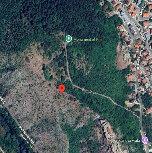
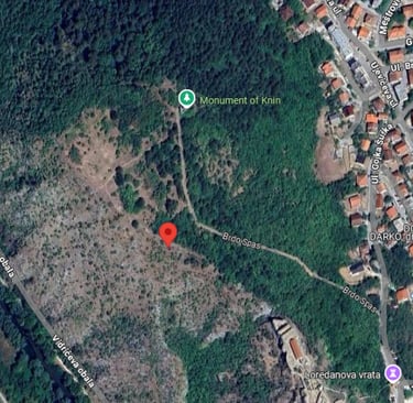
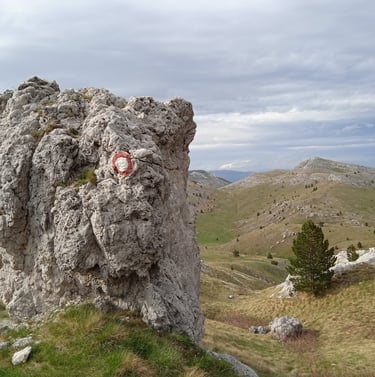
The Spas Hill-The Highest Spot In Town
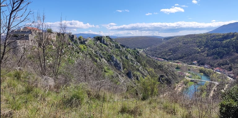
To get to this spot from the roundabout follow the road to the monument (see https://knavigator.info/partisan-monument-knin-and-knins-recent-history). From the monument a short path will take you to the top of the Spas hill (Spas means salvation) from where you have the spectacular view on the Fortress and river Krka.

Rivers and Lakes
Knin is advertised as the town on 7 rivers, but 3 major ones are the most interesting- Krčić, Krka and Butižnica. Cetina river and Šarena lakes are also mentioned here, they're not in Knin, they're close, but they belongs to different municipalities.
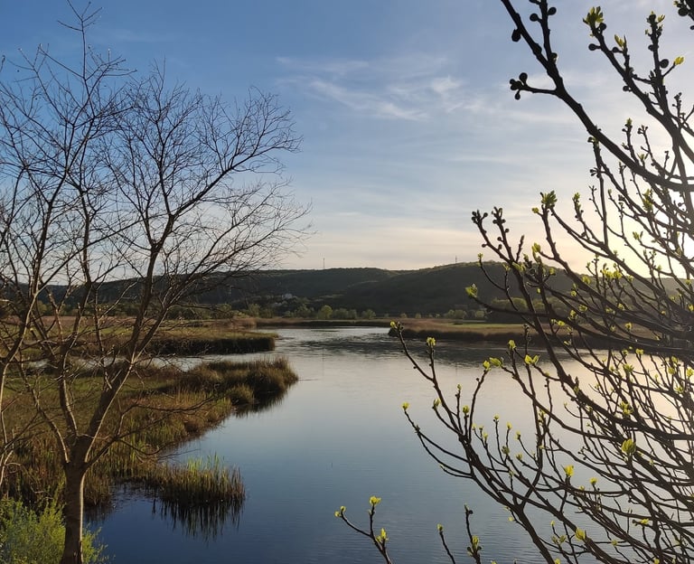
Šetnica (The Promenade) and Sastavci (Confluence)
Map: https://www.google.com/maps/d/u/1/edit?mid=1DGYGOae8g8ckZ8GEGQSfWP75QL0iaa4&usp=sharing
Šetnica is a promenade along the river Krka, which is connected with the path between Krka and Butižnica leading to the the confluence of these two rivers (Sastavci).
If you want to connect these two paths which are traversable on foot or by bicycle just follow the right bank of Krka.
The part of the path between Krka and Butižnica towards confluence also follows the right bank of Krka.
Even though the path following the left bank of Krka is marked on Google Maps, after a point you'll come across a fence and you won't be able to continue. It would be best to stick to the path between 2 rivers as marked.
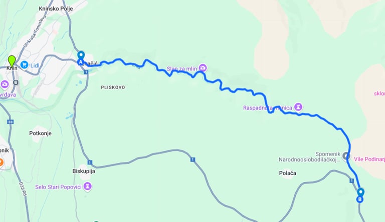
The Krčić Canyon and Napoleon Road
Note:
a) Krčić dries out during the summer months, if you want to see the cascades the options are late fall, winter or spring.
b) Napoleon Road is erroneously marked as Kričić, and Krčić as Krka on Google Maps
Map: https://www.google.com/maps/d/u/1/edit?mid=1kdVGBRGJ9qPcjZ82F1gXmomYEvr6RHs&usp=sharing
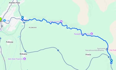
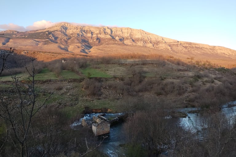
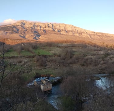
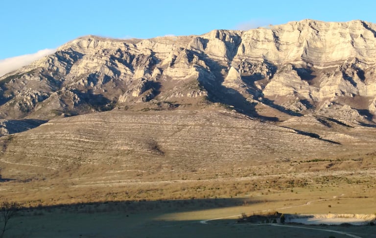
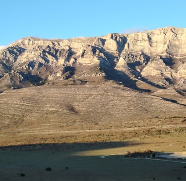
The Napoleon road is an old road from Knin to Split that starts close to the great Krčić waterfall. It mainly follows the Krčić canyon, so you can make stops on the way to to take pictures of the cascades and old mils.
If you're visiting during the early spring months the trip through the canyon is a treat. Cascades, old mils and Dinara in the background look beautiful in the photos and videos, but they are lacking the volumes and textures that can only be experienced on site. The Partisan monument is not far from the canyon following the road, you can see it on the map as the "Spomenik Narodnooslobodilačkoj Borbi". Dinara is in the East so the best time to visit if you want to catch the shades as in the picture below would be around sunset.
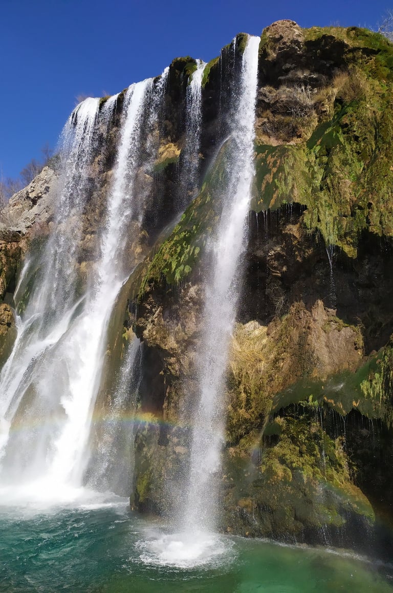
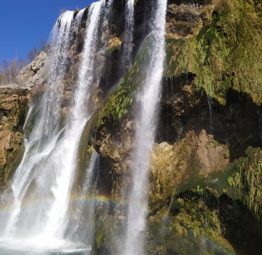
The Cascades on Krčić
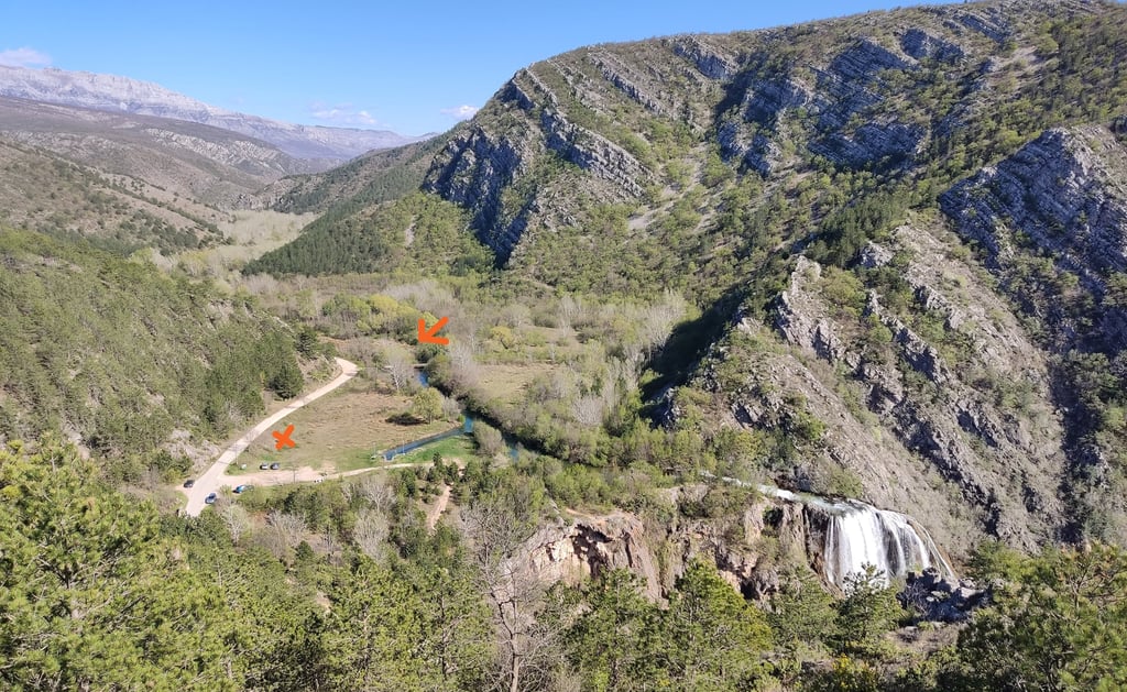
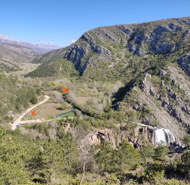
The starting points heading from knin-x marks the place where you can park your car the arrow marks the bridge to cross to get to the path
Note: See above under The Krčić Canyon and Napoleon Road
Map: https://www.google.com/maps/d/u/1/edit?mid=18F1Q0_lp7BHZpMmSc0juN2Qug3hRCKk&usp=sharing
The path along the left bank of the river Krčić is parallel to the Napoleon road, and it features some of the most beautiful cascades that can't be seen from the road. Lately it's been known as the path of the 5 cascades.
If you are coming from the direction of Knin, the starting points are marked on the picture, you can park on the field above the great Krčić waterfall and cross the bridge. After the bridge just follow the path, it's some 5 km long and it ends at the old mills.
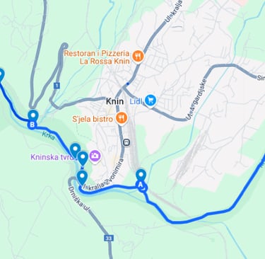
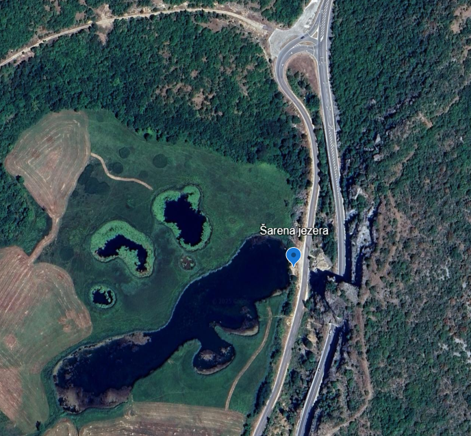
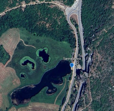
Šarena (the Colorful ) Lakes-Biskupija
Map: https://maps.app.goo.gl/DMovqLeb115DVwfo7
The view is the best from above, from the road to Split after the tunnel, but there's no place to stop to take pictures. You can get closer to the lakes by taking the turn to Biskupija before the tunnel at the fork junction visible on the map below. There is a sign, and you can park your car on the side of the road once you get there.
Unfortunately the place is usually littered with coffee cups, cigarette boxes, and plastic bottles.
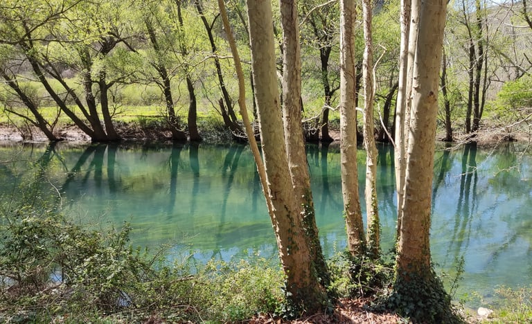
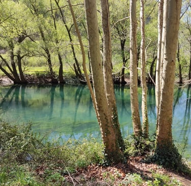
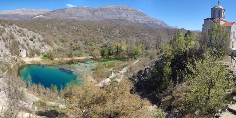
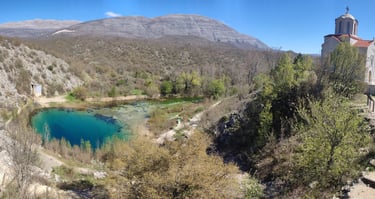
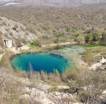
The Spring of the River Cetina-Civljane
Map:https://maps.app.goo.gl/f7iDoi9TNmqKPK3g7
Note: Swimming is not allowed
This is a well known karst spring some 35 km from Knin. It's accessible by car, though the road is narrow so that two cars can barely pass each other (same goes for the Napoleon road), and during the high tourist season it's known to be crowded.
The crystalline waters are tempting, especially on a hot summer day, but keep in mind that the water is very cold, some 9°C, and that this is the source of drinking water, so no swimming is allowed.
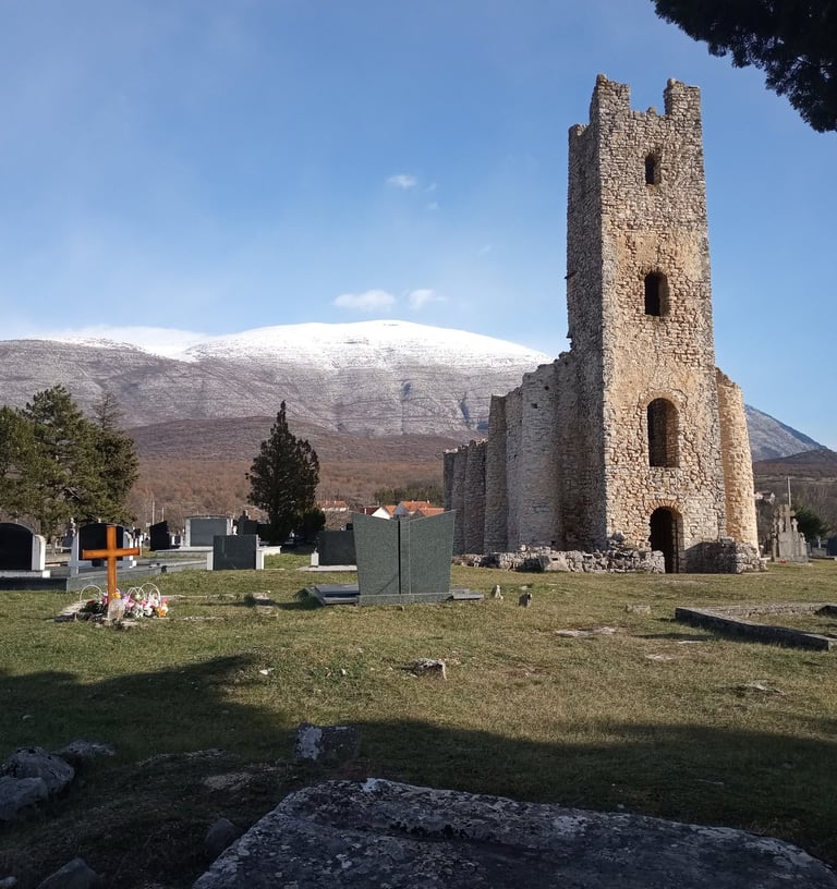
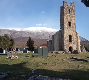
On the way to the spring you'll also be able to visit the remains of an old 9th century church Sveti Spas (The Church of Holy Salvation).


Dinara- The Highest Mountain in Croatia
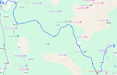
The road from Knin to Dinara starts at Fra Petra Kneževića St, and you can see waypoints on this map:
https://www.google.com/maps/d/u/1/edit?mid=1ekhFpnqrgJ7KXiD_f18q3JwVIJw96iI&usp=sharing
Note:
a) From May to October is the time when there's the least probability to run into the bad weather, but still make sure to check the forecast before you go
b) If you go by car, take a 4x4 or at least a car with a high ground clearance and make sure your tank is full, the road is quite bad and fuel consumption is high
c) Military organizes trainings on the mountain occasionally and during that period no activities are allowed.
Dinara is actually the Dinara mountain range, situated on the border of Croatia and Bosnia and Hercegovina. Sinjal (1831 m), the highest peak of Croatia is also called Dinara. Sinjal is one of the 4 peaks of the range, the second highest after Troglav (1,913 m), situated nearby in Bosnia and Hercegovina.
There is an alternative way from the nearby Municipality of Kijevo, but this one is more interesting in my opinion, and Badanj, another peak of Dinara is also on the way.
If a climb to Sinjal seems a lot you can stop at the spot marked on the map with waypoints to Dinara and climb Badanj instead.
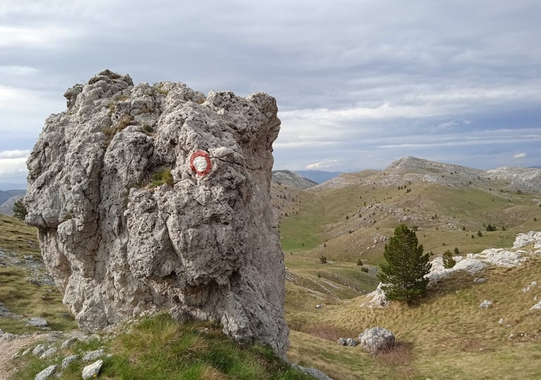
the path to sinjal
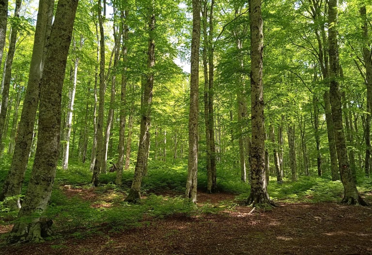
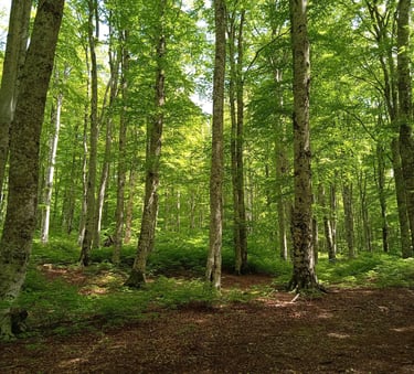
the beech forest -near brezovac mountain hut
Dinara


the ground close to the peak sinjal